Earth Nullschool - Global Real-Time Meteorological Visualization
文章目录[隐藏]
Introduction to Earth Nullschool
Earth Nullschool is a powerful online tool that provides a vivid 3D animated map, allowing users to track and intuitively understand global meteorological changes in real time. Driven by supercomputers, the platform updates its data every three hours, ensuring the timeliness and accuracy of the information.
Website Access
For access to Earth Nullschool, visit https://earth.nullschool.net/. Upon loading, you will be greeted with a default map displaying global wind speeds and directions.
Website Language
While the primary language of Earth Nullschool is English, the platform's international content and audience suggest that it may support multiple languages to cater to a global user base.
Features of Earth Nullschool
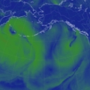
Earth Nullschool offers real-time meteorological displays, including detailed wind conditions, key weather indicators such as temperature and humidity, oceanic environment information, atmospheric conditions, and air pollutant monitoring. Its interactive map design allows users to switch between different data layers, adjust perspectives, and zoom in on any geographical location.
Industries and Fields Involved
The platform serves industries such as meteorology, oceanography, environmental science, and geographic information systems. It provides valuable educational resources and research tools for weather enthusiasts, educators, researchers, and environmentalists, enhancing the public's understanding of Earth's systems and fostering discussions on climate change.
Usage Scenarios
Earth Nullschool offers a range of services and functionalities, including real-time global meteorological visual experiences, educational insights, and research support. Users can explore meteorological phenomena on various scales, utilize the animation mode to visualize the Earth's climate system in real-time evolution, and interpret data through color coding and value ranges.
Technical Implementation
Behind Earth Nullschool lies the data processing power derived from global weather forecast models. These models integrate and analyze massive meteorological observation data using the computational power of supercomputers, forming high-precision predictions displayed intuitively to users worldwide.
How to Use Earth Nullschool?
Users can interact with the platform by zooming and panning the map, selecting meteorological parameters from the dropdown menus, controlling the timeline with a slider or date selector, changing viewpoints, and quickly locating specific areas by searching for city or region names.