Introduction to GIS Frontier
GIS Frontier is a public account dedicated to the field of Geographic Information Systems (GIS), committed to sharing the latest information, technical trends, application cases, and industry development trends related to GIS. It serves as a comprehensive platform for GIS professionals, scholars, students, and enthusiasts to learn and communicate.
Content Positioning
The content of GIS Frontier mainly revolves around the application and development trends of GIS technology, covering a full range of information from basic theory to practical cases. It aims to provide a platform for learning and communication for GIS professionals, scholars, students, and readers interested in GIS.
Main Columns
- Technical Sharing: Introduces the core technologies of GIS, such as spatial data analysis, remote sensing image processing, and geographic data visualization.
- Industry Dynamics: Reports on the latest developments in the GIS industry, including policy changes, market trends, and major projects.
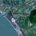
- Case Analysis: Showcases practical application cases of GIS technology in urban planning, natural resource management, environmental monitoring, and other fields.
- Academic Frontier: Shares the latest research achievements in the field of GIS, including academic papers, research reports, and academic conference information.
Featured Content
- Aerial Survey Full Process Analysis: Detailed explanation of the entire process of aerial survey from project establishment to result approval, including demand analysis, flight design, airspace application, aerial operation, photogrammetric control measurement, aerial triangulation, interior collection, and result approval.
- Interpretation of GIS Development: In-depth interpretation of the development of GIS technology, such as the progress of intelligent perception technology and the role of GIS in data culture and computational society.
Interaction and Participation
GIS Frontier encourages readers to participate in interactions through comments, questions, and other means to engage in discussions about GIS technology. In addition, the public account will regularly hold online or offline exchange activities, such as seminars and workshops, to promote the exchange and sharing of knowledge.
Audience
- GIS Professionals: Provides the latest industry information and technical trends for practitioners in the GIS industry.
- Scholars and Researchers: Shares academic research achievements in the field of GIS to promote academic exchanges.
- Students: Provides learning resources for GIS students to help them understand industry trends and employment directions.
- Enthusiasts: Provides popular science knowledge for ordinary readers interested in GIS to increase their understanding and comprehension of GIS.
Development Vision
GIS Frontier is committed to becoming the most influential information sharing platform in the field of GIS. By providing high-quality content, it promotes the development and application of GIS technology and provides a growing environment for members of the GIS community.
Conclusion
GIS Frontier is a rich and professional information sharing platform in the field of GIS. Whether you are a professional in the GIS field or an ordinary reader interested in GIS technology, you can find valuable information and knowledge here. As GIS technology continues to advance and expand its application fields, GIS Frontier will continue to provide readers with the latest industry information and in-depth analysis, witnessing the development and transformation of GIS technology.